If anyone's interested, I used the trails we ran Saturday, along with the ones we ran back in May, and traced out a very basic map of the park for the GPS app on my phone:
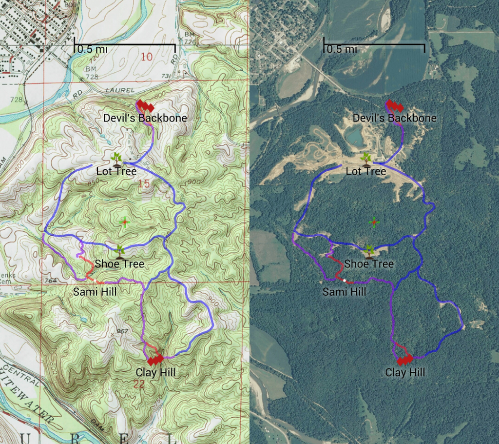
It's loosely color-coded so that:
Blue - Fire Roads, tow-rig passable
Purple - Basic Trails, open-diff passable
Red - Moderate Hills, lockers helpful
Red Diamonds - Challenging Hills, lockers almost required.
Again, it's very basic, and I didn't bother to trace more than a quarter of the trails we ran. I'll continue to add trails as I see fit, but (1) if you plot every trail at Haspin, it'll look like a bowl of spaghetti. And (2) this is enough to get a feel for the layout of the park, and help you get from point A to point B. (I was always embarrassed just how lost I was out there!)
I've got it as a GPX file, I can share it via email if anyone wants it...
Robert